Northwest Surfriders
Netarts, OR area information
Click on the map link then click on the placemarks on the left side.
The placemark menus can provide directions to get there
Click on Satellite to get a bird's eye view of the area.
Pictures taken at each location precedes the description of the location
Map of the area of Netarts, OR
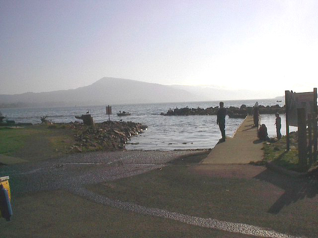
This is where we launch for Ocean freerides at Netarts bay.
In Tillamook go West on Hwy 131to Netarts follow signs to boat ramp.
Paved ramp, floats, not tide dependent, plenty of parking.
It's quite a ways to the ocean, wide and shallow bar.
Click here for tide tables
Very busy with other users, but haven't heard of any
problems. PWC's have been used here for fishing, and crabbing.
Latitude/Longitude location: 45.430805,-123.946552